For your next vacation or adventure…
Are you are looking for a local/regional excursion afoot or by wheelchair, bike, bus, or train? Are you looking to extend your wings without a car? If you live in the Lehigh Valley, you can do so, in many cases from right outside your door. How much time do you have? 1,2 or 5 days? Where do you want to go? What do you want to do?
- An epic bike ride! The Greater Allegheny Passage (GAP) trail and the C&O Canal. Take the bus to Pittsburgh with your bike and ride to Washington D.C., and return via Amtrak to Philly and bus back to the LV.
- Bike to Philadelphia or New York City and return by bus!
- Take LANta Bus to Wind Gap, or Roseto/Bangor to hike the Appalachian Trail or visit Columcile Megalith Park!
- Take Greyhound from Easton to Delaware Water Gap and hike, bike or paddle in the National Recreation Area!
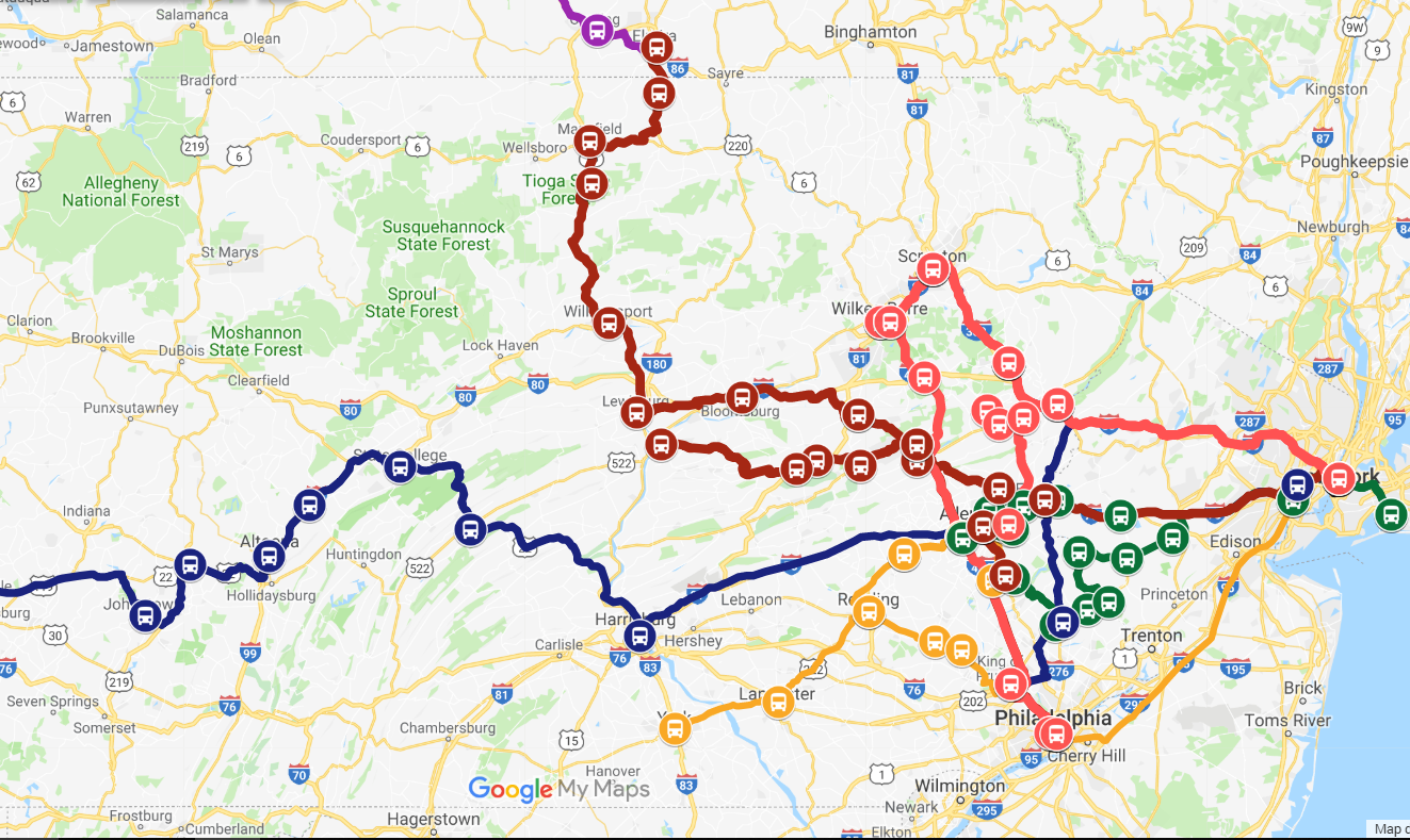
Check out our map for where you can go by long-distance bus.

Planning a Multimodal Adventure
Look at a map and choose a new place to visit within a 100 mile radius… a new city, verdant mountains with waterfalls, farm country or the New Jersey seashore.
If you can bicycle 20 miles a day, you can get there in 4-5 days… and along the way, the people, sites and nature, can be as fun as the destination.
Buses WITHIN the Lehigh Valley
LANta Bus would be our first choice within the Lehigh Valley (within Lehigh and Northampton Counties). LANta Bus can also be very useful to get from your house to a transportation hub for a long distance bus.
Buses Beyond the Lehigh Valley
Try bicycling somewhere that is served by a long-range bus operator.
Check out our map for ideas where you can go by long-distance bus.
Private bus companies such as Greyhound, Bieber, Susquehanna Trailways, Transbridge serve many destinations in Pennsylvania. Most, if not all bus companies allow bicycles in the the stowage compartments beneath their buses.
For the walking/bicycling legs of a trip: try mapping services such as Google Maps, where you can choose a walking route, which follows the shortest distance on roads, or a bicycling route, which uses  roads and multi-use trails that range from paved to mud and rocks (an adventure, but usually hybrid bike friendly). Google Maps bicycling directions will also show you an elevation profile of your route. I like to transcribe the route to Word or similar so that I can delete extra lines and print as two column layout. The mileages between turns are very helpful and easiest with a cyclometer on your bike, so you won’t need to rely on GPS or a smartphone while on the road/trail.
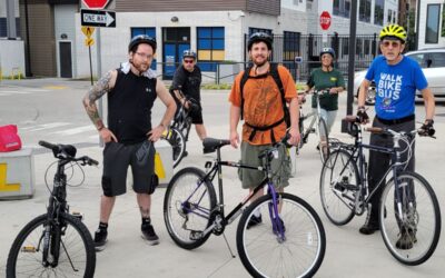
I have just returned from three days bicycling from Easton, PA to Lancaster, PA, attending the super fun wedding of Amy & Tom riding the D&L and Saucon Rail Trails to DeSales University, then to Fogelsville for the reception and camping for the night. On the second day, a long ride past the Rodale Institute, through Kutztown, visiting friends and their beautiful land in R eading, PA. A few multi-lane arterials near Reading, but reasonable with practice, focus and riding predictably. A long, sweet ride to Lancaster and beyond to Holtwood over mostly quiet rural farm roads. A day to rest and enjoy company of sweet friends, the Clatterbucks, living life, being parents, being children, enjoying nature, music, juggling and ping pong – and taking a three year stand for the land where a 42″ natural gas pipeline is proposed to run through woodlands and beneath active Amish farms. On the fourth day, riding to meet the Bieber bus in Lancaster, transferring in Reading with two hours to ride around the city, and finally disembarking in Hellertown, with a short ride to the D&L trail and back toward Easton.
Contacts with various groups (American Bus Association, Pennsylvania Bus Association and Greater New Jersey Motorcoach Association) have bus company member listings, but no system-wide map of service routes, which in my opinion could really help travelers.
This article also inspired by CAT members Edwin and Janice Kay who last week completed a bike tour from Alabama to Erie, PA in 28 days, covering 1400+ miles on a tandem bicycle. They used Amtrak from Philadelphia to get to their starting point. Ask them if it was a worthwhile adventure!
 Other thoughts:
Rail Service
UPDATE 12/31/2018, SEPTA Lansdale/Doylestown trains have been added to our map above.
NJ Transit reaches High Bridge and Hackettstown, NJ
Amtrak has a few lines in Pennsylvania that can be fun and easy (bicycles are permitted between stations that have staff to access the baggage car):
- Pennsylvanian Line (Phila-Harrisburg-Pittsburgh)
- Keystone (Phila-Harrisburg)
- Northeast Corridor (Boston-NYC-Phila-D.C.)
- Crescent Line (NYC-Phila-D.C.-New Orleans)
- Service from Phila to Florida
Check out this live updating national map of Amtrak trains!


0 Comments